Telemetry Studio
Sync cycling telemetry data with professional video themes
@bart
Details
- Follow on
- @bartlomein
- Target Audience
- Content CreatorsNon-Technical Users
- Platforms
- Web
- Featured in
- Best Video Editing Tools
Discovery signals
How AI and people discover Telemetry Studio on PeerPush
About Telemetry Studio
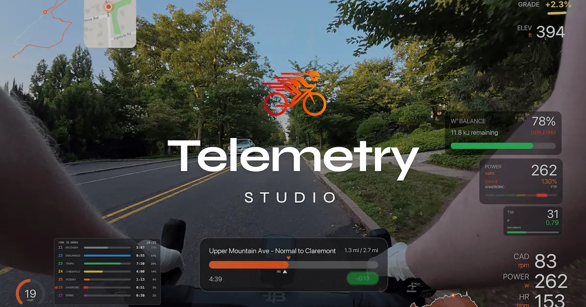
Create professional cycling videos with real-time data overlays. Sync your speed, power, heart rate, and route to video footage automatically. Native Strava integration shows live segment tracking, KOM gaps, and PR celebrations. 10 visual themes, 19 overlay types, 4K export. What takes hours in traditional editors takes minutes here. One price, yours forever.
Product Video
Watch a video demo of Telemetry Studio.
Screenshots
Reviews (0)
No reviews yet. Be the first to rate this product!
Comments (6)
Wow, this is so cool - sleek and nice looking overlay!
This would actually be a fun way to make a bit of side content during my commute! Really digging it.
Nice UI!!
Cyclists myst be thrilled by this.
👏👏
Can I add my own custom data?
@asupkay1124 Thanks for the comment! Do you mean custom overlays? You can add animations and we have 19 different overlay types. You add your own data using gpx/fit files or strava. Hope this answers your question