Useful AI Tools - Satellite Analysis

Useful AI Tools - Satellite Analysis

Find any object in satellite imagery with AI

eyasuasnake6464
@eyasuasnake6464
Published on Mar 31, 2026
Visit site
1 PeerPush
🚀
Awarded
Just Launched
PeerPush

Details

Platforms
Web

About Useful AI Tools - Satellite Analysis

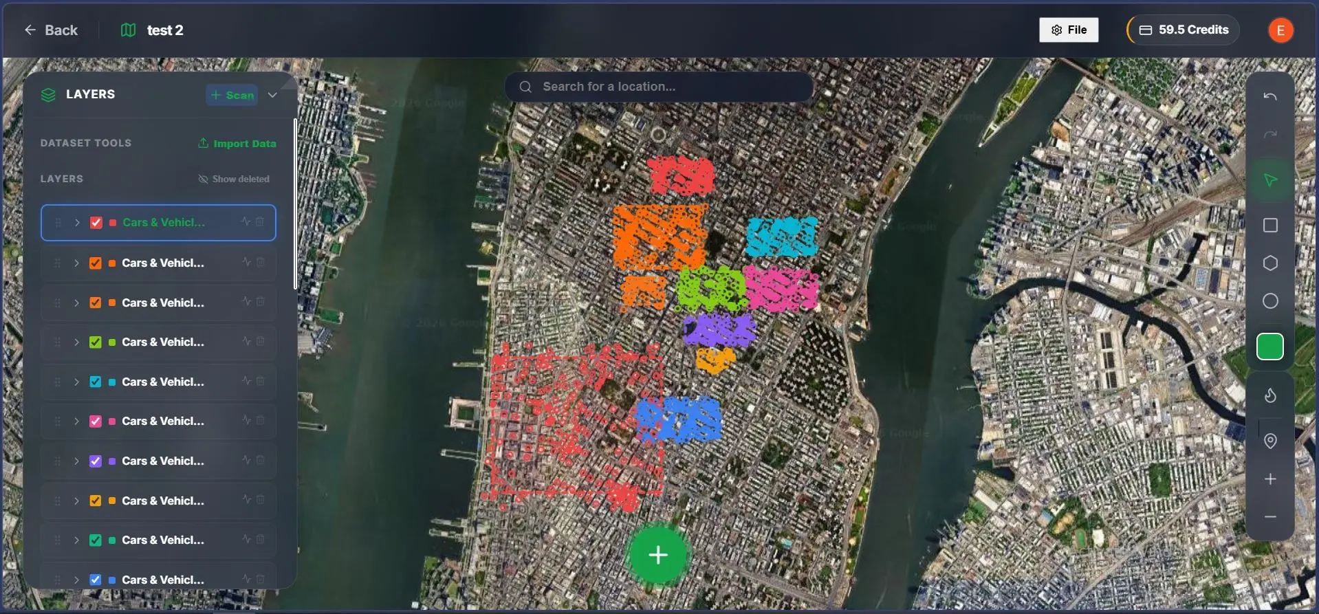
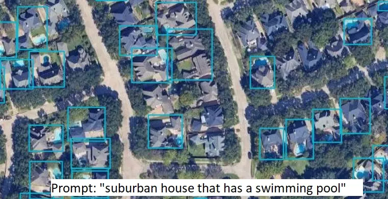
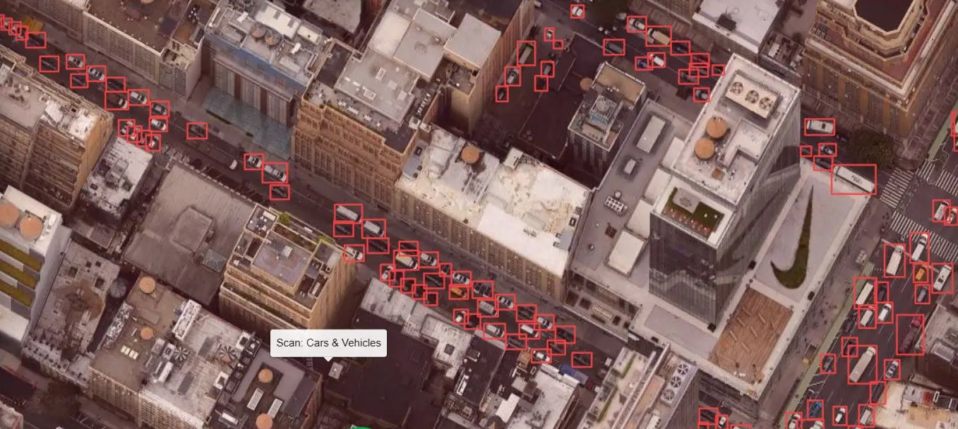
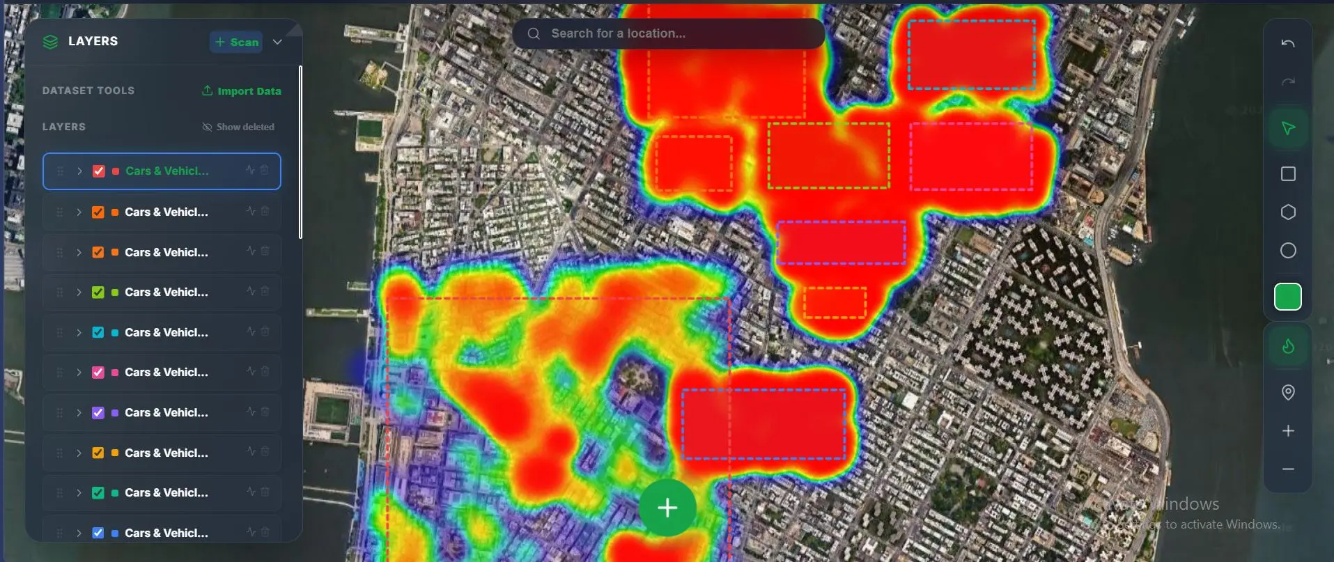
Useful AI Tools lets you detect any object in satellite imagery just by typing what you're looking for. No model training, no GIS expertise needed. Draw an area on any map. Type a prompt like "swimming pools," "oil tanks," or "solar panels." The AI scans every tile and projects bounding boxes directly onto the globe. - Zero-shot detection (no custom training) - GeoJSON & CSV exports for QGIS/ArcGIS - Density heatmaps & spatial analytics - Free demo no login required

Product Insights

This web-based AI tool enables zero-shot object detection in satellite imagery across various industries like energy and urban planning. It provides a technical bridge for non-GIS experts by converting text prompts into spatial analytics and exportable geographic data.

  • Zero-shot detection requires no custom model training or coding.
  • Exports data directly to industry-standard GeoJSON and CSV formats.
  • Provides spatial analytics including density heatmaps and bounding boxes.
  • Lower barrier to entry with a no-login free demo for web users.

Ideal for: Non-technical users and data scientists who need to perform spatial analysis on satellite data without specialized GIS expertise.

Screenshots

Screenshot 1 of Useful AI Tools - Satellite Analysis
Screenshot 2 of Useful AI Tools - Satellite Analysis
Screenshot 3 of Useful AI Tools - Satellite Analysis
Screenshot 4 of Useful AI Tools - Satellite Analysis

Reviews (0)

No reviews yet. Be the first to rate this product!

Comments (1)

eyasuasnake6464
@eyasuasnake6464

Hey, I'm the solo developer behind this project. Here's the story: I got frustrated with the traditional remote sensing workflow. If you want to detect "cars," you train a CNN on a cars dataset. Need